John Jarratt Collection
Transcription file from the collection on deposit at
The Victoria Regional History Center
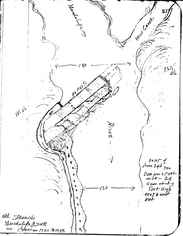
OLD SPANISH GUADALUPE
RIVER DAM
1726 to 1749
(below intersection of Guadalupe River and Price Creek)
| Notations: |
| 80 feet of dam left in 1966 Dam was 6 feet wide and is now about 7 feet high next to West end Elevation of banks: 125 feet Width of river above dam: 180 feet Width of river below dam: 150 feet |