John Jarratt Collection
Transcription file from the collection on deposit at The Victoria Regional History Center
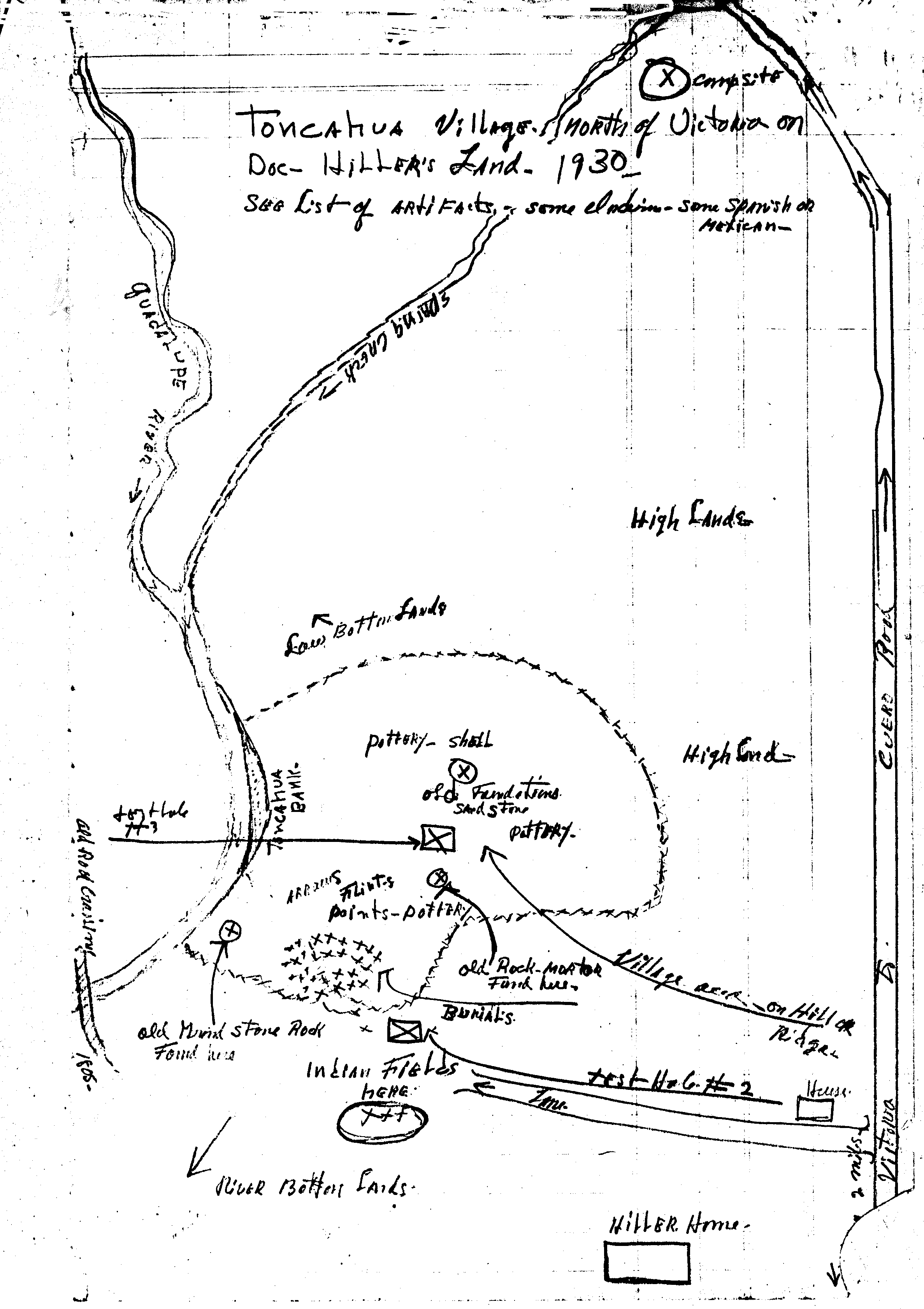
Toncahua Village North of Victoria
on Doc Hiller's Land - 1930

Drawing #1

Drawing of village

Notations: Top left quadrant

  • Guadalupe river
  • Guadalupe River
  • Spring Creek
  • Low bottom lands
  • Toncahua Bank
  • Pottery - shells

Notations: Top right quadrant

  • Campsite
  • High lands
  • Cuero Road
  • High lands
  • Old foundations - sandstones

Notations: Bottom left quadrant

  • Test hole # 1
  • Arrowheads - flints - points - pottery
  • Road crossing
  • Old grind stone rock found here
  • Indian fields here
  • River bottom lands

Notations: Bottom right quadrant

  • Pottery
  • Old rock mortar found here
  • Village area on hill or ridge
  • Burials
  • Test hole # 2
  • Lane
  • House
  • Hiller home
  • Victoria 2 miles
  • Victoria to Cuero road