John Jarratt Collection
Transcription file from the collection on deposit at The Victoria Regional History Center
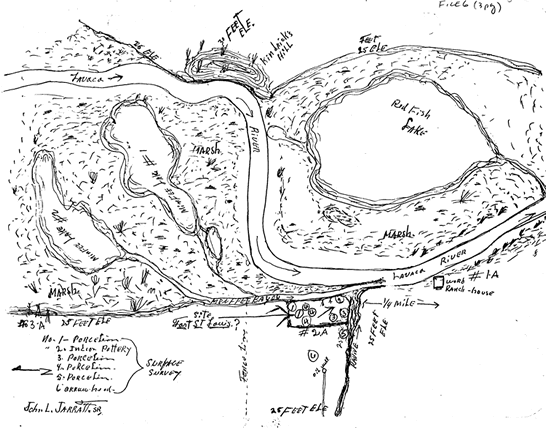
POSSIBLE SITE OF FORT ST. LOUIS

Drawing of possible site of Fort St. Louis

Notations:

  • Kindrick's Hill (elevation 30 feet)>li>
  • Lavaca River
  • Red Fish Lake
  • Menefee Lake #1
  • Menefee Lake #2
  • Marsh
  • Menefee Bayou
  • Site Fort St Louis?
  • Fence line
  • Oil well
  • Ravine
  • Ward ranch house

Surface Survey:

  1. Porcelain
  2. Indian pottery
  3. Porcelain
  4. Porcelain
  5. Porcelain
  6. Arrowhead