Transcription from original document owned by
The Victoria Regional History Center
VC/UHV Library
Materials Use Policy

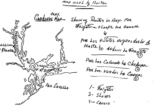
Map Used by Bolton

Cardenas map of Texas coast showing routes in bay for frigates, sloops and canoes.  Notes following this image have more explanation.

Copy: Cardenas map - Showing routes in bay for frigates, sloops, and canoes

Notations on side (Library does not have original coloring for dotted lines):

Por los puntos negros desde A hasta L anduvo la fragata
[By the black dots from A to L went the frigates]
Por los colorado la chopupa
[By the red the sloops]
Por los verdes la canoa
[By the green the canoes]

Frigates
Sloops
Canoes


Notations on drawing:

Rio de francies (franceses ?)
X ?ablicion de frances
Largo (lago ?) de St. Bernardo
Pass Cavallo