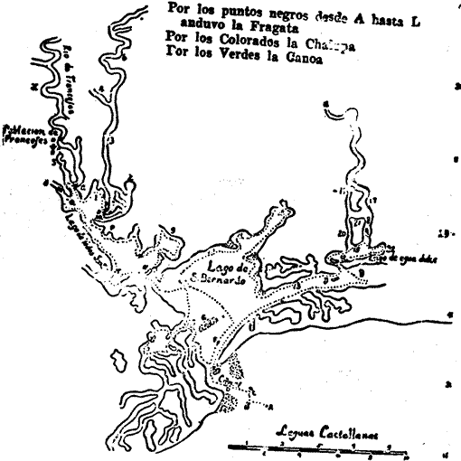
ANCIENT MAP FOUND BY BOLTON
See also: Cardenas Map

| Notations (from upper left): |
| Poblacion Franceses Rio de Franceses Lago de (Todos Santos) (?) Lago de S. Bernardo Lago de Agua Dulce Legend: Leguas Castellanas |
| Por los puntos negros desde A hasta L anduvo la Fragata (Along the black dots from A to L traveled the frigates) Por los colorados la Chalupa Port los verdes la Canoa NOTE: Library does not possess map in color to show dotted lines. |